華埠社區地圖 Mapping Chinatown Calgary
REFLECTIVE URBANISMS
Mapping Calgary Chinatown
Through Transformations in its Architecture
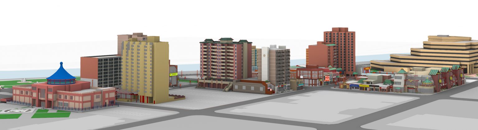
REFLECTIVE URBANISMS is an interactive web project that maps Calgary Chinatown through its architectural changes. Here, transformations that have occurred in its buildings, since Chinatown was established in its current location in 1910, are visualized and investigated alongside community stories about the histories and activities that took place in, outside, and around these buildings.
https://www.reflective-urbanisms.com/c/buildings/
https://cmagazine.com/articles/linda-maes-an-architectural-past-life
Places
卡城華埠 Calgary Chinatown
Calgary, Alberta
廣東樓區 Canton Block serves as a symbol of the establishment of the current Chinatown
Road Map
Calgary, Alberta
Popular VisitLists
test
Winnipeg, Manitoba 1 place
this is a test.
View VisitList
Atlantic Canada’s Hidden Histories
Shelburne, Nova Scotia to East Preston, Nova Scotia 62 places
geocaches that demonstrate the rich, diverse histories of Atlantic Canada.
View VisitList
Isle Madame – The Explorer’s Island #CanadianVisitList
Arichat, Nova Scotia 9 places
History and heritage awaits!
View VisitList
Parks Canada #VisitLists for when you can’t get away
Saint Lunaire-Griquet, Newfoundland and Labrador to Louisbourg, Nova Scotia 5 places
Parks Canada’s ReCollections podcast will take you all over this great country.
View VisitList