Diana Icelandic Cemetery - Historic Places Days

Diana Icelandic Cemetery

Sinclair, Manitoba
Type
Geocache
Address
FJQW+848 Sinclair, Manitoba, Canada
Get directions
Hours
24/7

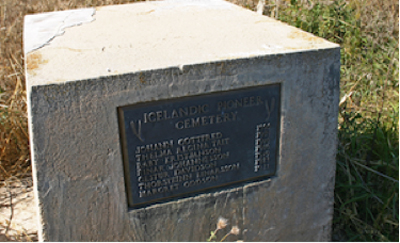
This Geocache site is brought to you by the Turtle Mountain Souris Plains Heritage Association. Lat: N 49°29.298’   Long: W 101°21.280’

Note that the accompanying map may not be completely accurate. For exact directions to this location, search Google Maps using the coordinates given, or visit geocaching.com. For more historical information visit our website at vantagepoints.ca.

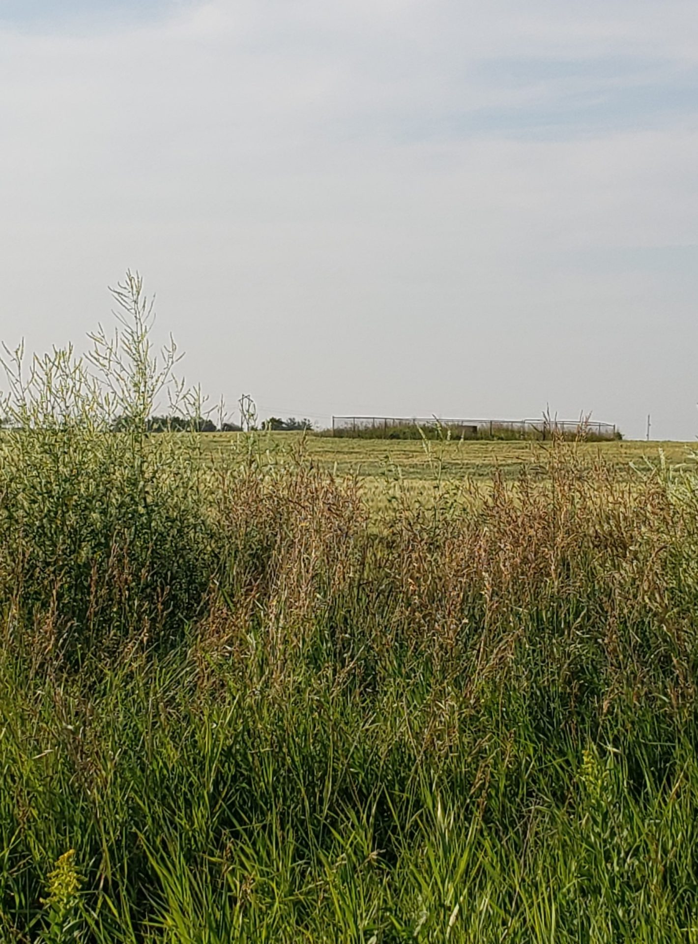
A fenced enclosure in a farmer’s field, just barely visible from the nearest road, contains a cemetery. There is a very rough trail, sometimes drivable in summer, if you have a truck or SUV, or you can walk in from the gravel road.

The first settlers to arrive in the community that was to become the Diana district were Icelandic. They had originally come to the New Iceland settlement at Gimli beginning in 1876. Some had moved on to the Grund area between Baldur and Glenboro in the early 1880’s, and when homesteads were becoming harder to find, a few moved west to the area between Sinclair and Tilston.

The largest group settled in the Diana district in what was then Albert Municipality. Perhaps because of distance, or perhaps because Icelandic settlers had their own distinctive burial traditions, they established their own cemetery rather than use nearby ones.

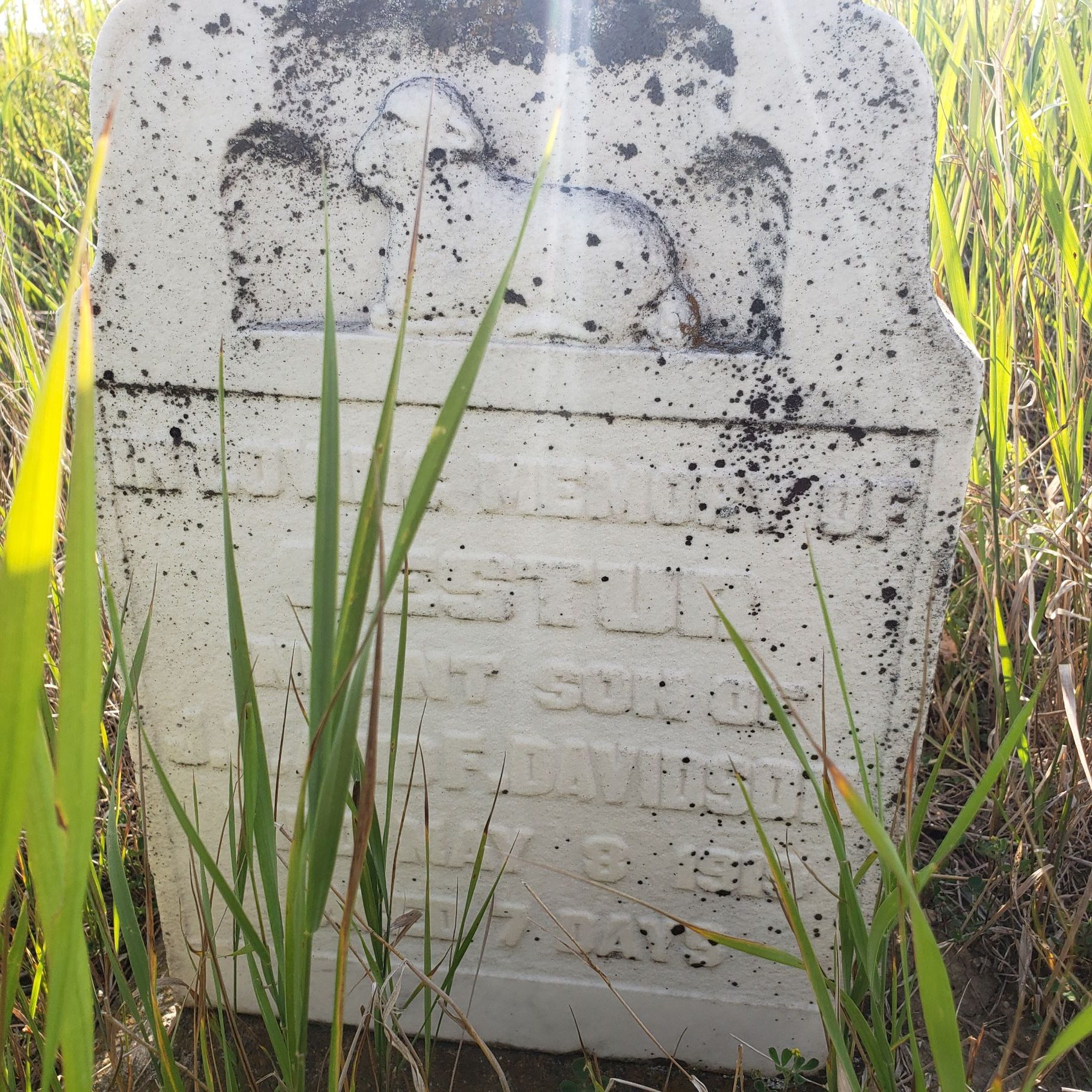
The cemetery contains seven graves, all unmarked but one. A small, weathered white granite headstone bears the word “Baby” and below it is the name Gestur, infant son of J. F. and F. Davidson, who died on May 8, 1919, at the age of seven days. Three unmarked stone slabs can be seen in the east half of the cemetery. A monument in the cemetery lists the names of the seven people buried there.

Sources:  Manitoba Historical Society; Albert R.M.: Reflections of Time: A History of the R. M. of Albert; Tilston: The Municipality, 1984; Trails Along the Pipestone, R.M. of Pipestone History Project, 1981; Photo credits: cemetery photos from summer of 2013 by Gloria and Barry Hill.

Amenities

  • Parking

Fun Facts

The access road is a public road allowance, but in a marshy area, and barely even a trail. The Geocache site and cemetery are best visited later in the season when it is not so wet. Visiting the cemetery involves trekking through a farmer’s field. There is permission to do so, but care should be taken to minimize disruption.

Location

FJQW+848 Sinclair, Manitoba, Canada
Get directions

Nearby Places

Napinka School

Napinka, Manitoba
Historic building in Napinka. Lat: N 49°19.483′ Long: W 100°50.667′
View Place | Get Directions

Alfred Gould’s House – Sourisford

Coulter, Manitoba
Historic site within Municipality of Two Borders. Lat: N 49°08.024′ Long: W 101°00.480′
View Place | Get Directions

Virden Pioneer Home Museum

Virden, Manitoba
Virden Pioneer Home Museum is a representation of Victorian life on the prairies.
View Place | Get Directions

The Empress of Ireland

Coulter, Manitoba
Geocache near village of Coulter MB Lat: N 49°05.322′ Long: W 100°59.039′
View Place | Get Directions

Register A Place

Create an account to add your historic place.

Make a VisitList

Welcome! To get started on a VisitList, you’ll need to have an account with #HistoricPlacesDays.


Already have an account? to sign in.
We use your contact information to process your registration and correspond with you about the National Trust and its programs. You can unsubscribe at any time. We care about your privacy. Read our privacy statement.

Sign In

Sites that participate in #HistoricPlacesDays need to have an account.

Welcome! To get started on a new VisitList or to edit an existing one, you’ll need to have an account with #HistoricPlacesDays. Sign in below!


Not registered? Click here to create an account.

Forgot Password

Enter your email address to request a password reset.


to sign in.

Get the latest scoop on everything #HistoricPlacesDays – join our e-newsletter and never miss a beat.