Coordinates:
45.48240°N 73.54802°W
Goose Village ( Village-aux-Oies ) was a neighbourhood in Montreal, Quebec.
Its official but less commonly used name was Victoriatown, after the adjacent Victoria Bridge. The neighbourhood was built on an area formerly known as Windmill Point, where thousands of Irish immigrants died from disease in 1847 and 1848. The entire neighbourhood was demolished in 1964 as part of preparations for Expo 67, to be replaced by a football stadium and parking lot.
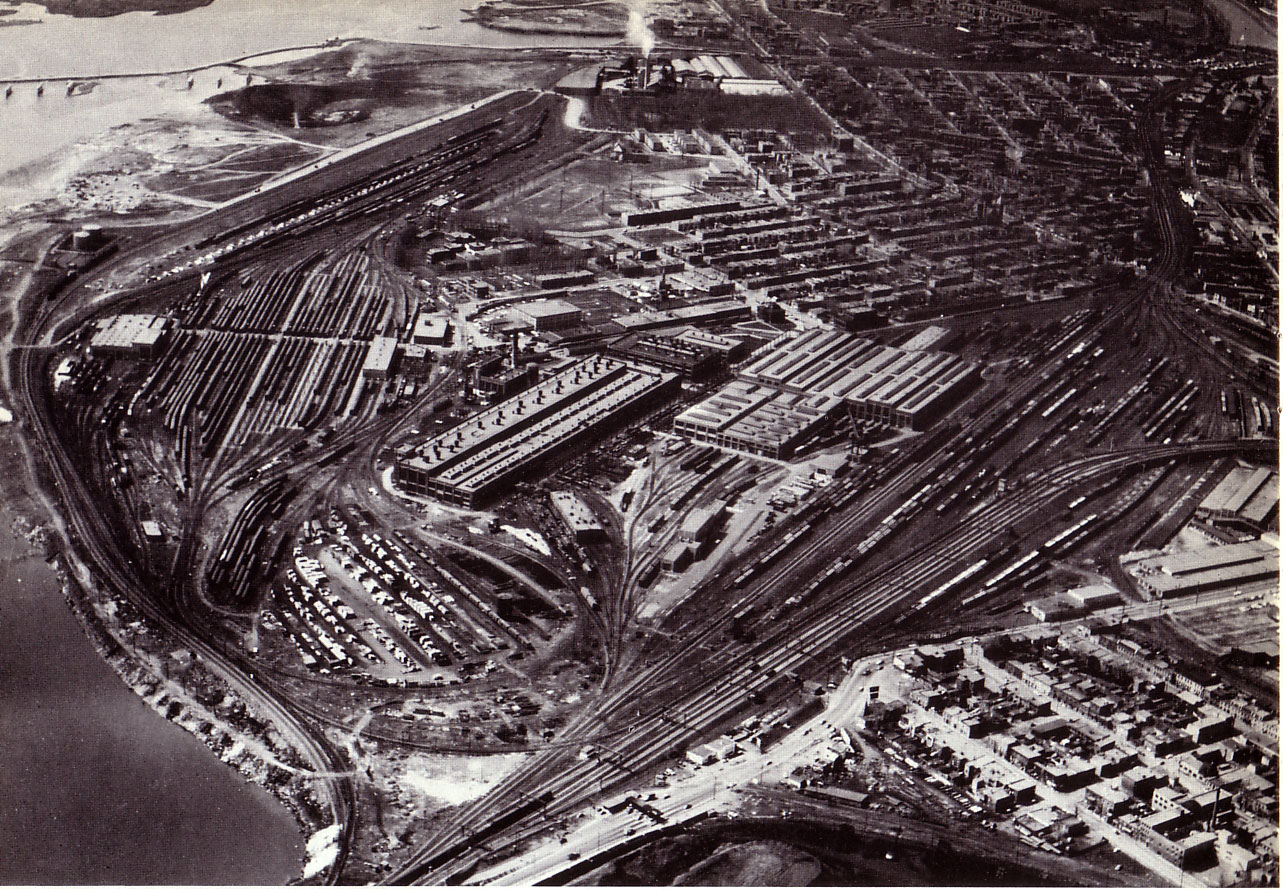
Goose Village was located near Griffintown, in what is now the southwest borough. The community encompassed six streets, in what is now a bus station and parking lot. The streets were named after various bridges designed by the principal engineer of the Victoria Bridge, Robert Stephenson.
Windmill Point was a quarantine area where between 3,500 and 6,000 Irish immigrants died of typhus or “ship fever” in 1847 and 1848. The immigrants had been transferred from quarantine in Grosse Isle, Quebec.
Grey Nuns cared for the sick, carrying women and children in their arms from ships to the ambulances.
According to Montreal journalist and historian Edgar Andrew Collard, thirty of 40 nuns who went to help became ill, with seven dying. Other nuns took over, but once the surviving Grey Nuns had convalesed, they returned. Priests also helped, many falling ill after hearing the last confessions of the dying. When a mob threatened to throw the fever sheds into the river, Montreal mayor John Easton Mills quelled the riot and provided care, giving patients water and changing bedding. He died in November, having served less than a year in office.
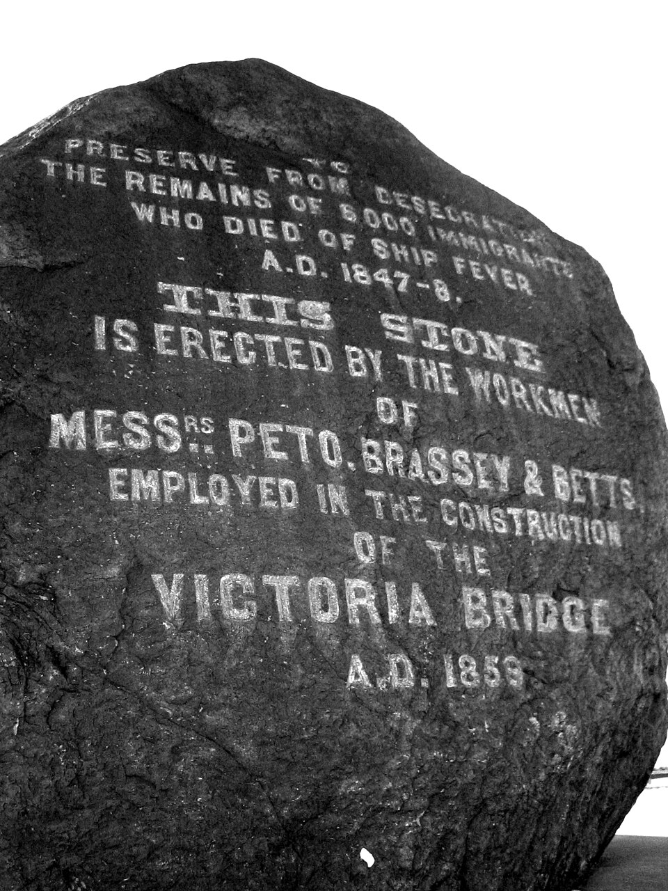
The Black Rock | Irish Commemorative Stone
A large black rock was erected in 1859 by workers to honour the victims, whose remains were uncovered during the construction of the Victoria Bridge. Its official English name is the Irish Commemorative Stone, but it is more commonly referred to as The Black Rock.
Demolition – 1964:
By 1960 most of the residents were Italian Canadians.
The Italian residents, many of whom had arrived in Montreal after the Second World War, often came to Goose Village in search of a “place of their own” with a small backyard on which to relax after work and grow tomatoes, zucchini, and other vegetables that were a part of Italian cuisine. The quaint village included St. Alphonsus School, Piche’s store, and a local cafe that served what was widely regarded as the best fish and chips to be found in the larger metropolitan area of Montreal. Bus no. 2A, driven by Roland (“Flirt”) Desourdie, served the community, which was home to over 300 families.
Greater Montreal was preparing for Expo 67, leaving the fate of the village—deemed an embarrassment by the city of Montreal and mayor Jean Drapeau—in doubt. The city compiled a report analyzing the living conditions in the area, which referred to a variety of drawbacks to the living conditions, which varied from many houses having no bathroom windows, to the wicked stench that came from the stockhouses in the area.
Campaigns were undertaken to save the village, but behind the scenes political manoeuvers had doomed the town from the start.
The town was simply bulldozed in 1964, leaving only the fire station, train station, and the Black Rock memorial to note the passing of a proud community. The decision to raze the community put the many families out of their residences, consigning to memory the history of the village.
Many of the razed homes had been built in Victorian style, but this alone was not enough to save them from demolition.
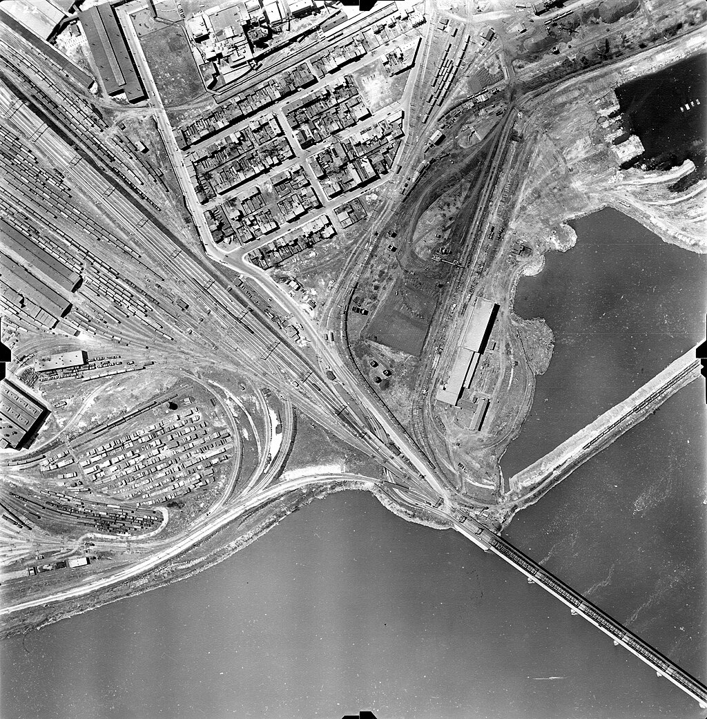
The planners of the Expo 67 World’s Fair also wanted the site of Goose Village for a transportation system for the fair. A very large parking facility was built on part of Goose Village. Visitors to Expo 67 would park their cars there and then travel to the main site of Expo 67, located on Saint Helen’s Island and Notre Dame Island, by high-speed electric train. This transportation system was completed in time for Expo 67 and was used successfully until the early 1970s when the World’s fair closed down. Expo 67 had been so successful that it was extended for several years after 1967 under the name “Man and His World.” The high-speed train, dubbed the Expo Express, ran from the former site of Goose Village to the Expo 67 site from 1967 through the autumn of 1972. Additionally, provincial highway planners also wanted part of the Goose Village land for the construction of an elevated expressway – the Bonaventure Expressway – between the new Champlain Bridge (which was inaugurated in 1962) and downtown Montreal, with an exit ramp leading to the Expo parking lot at the former Goose Village. The expressway opened in 1967 just in time for the Expo 67.
Goose Village has been referred to as “sacred” and “special” by former residents.
Efforts by former residents of Goose Village to rebuild their community were blocked by the city, which claimed that soil in their plot of land was too polluted for residential use.
Photo Reference:
•Aerial view of the Goose Village neighbourhood, 1947-1949 (Archives de la Ville de Montréal)
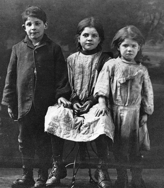
•Goose Village children, c. 1910
• The Black Rock, commemorating thousands of Irish “ship fever” victims | The Black Rock on Bridge Street, with plaque
References:
• https://ville.montreal.qc.ca/memoiresdesmontrealais/goose-village-le-village-aux-oies-ou-victoriatown
• https://walkmontreal.com/walks/victoriatown-a-k-a-goose-village/
• https://www.wikiwand.com/en/Goose_Village
• Griffintown and Point St Charles Archived September 28, 2007, at the Wayback Machine, Quebec Heritage Web accessed 2008-01-20
• Gravenor, Kristian (July 20, 1987). “Studies in Citizen Response: Community Reaction to the Threat of Demolition in Goose Village and Milton Park, Canadian Urban History, Concordia University”.
keepandshare.com